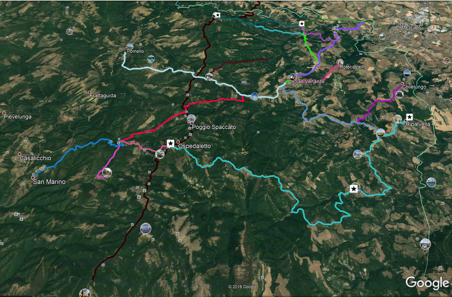
Ospedaletto – Poggio Spaccato – Palazzo Bovarino
Distance (km)
Elevation gain (m)
For this route you need to download the map on your mobile or GPS.
This ring is made up of sections of three historic roads: Via Orvietana, the road between San Venanzo and Palazzo Bovarino and the one between the latter village and Ospedaletto.
From the centre of Ospedaletto (coffee bar in the North and church in the South) we continue along the state road towards San Venanzo (we are on the ancient Via Orvietana) until Albergo Tulliola, beyond which we take a narrower asphalt road uphill, following which we arrive at Poggio Spaccato and then we return to the state road. After following the state road towards the North for just 180 meters, we take a gravel road on our left (towards the West) which is slightly downhill. Continuing West-southwest we pass Podere Colianni and going down we will have to pay attention to a ruin on our right, after which we turn left (South) on a small grassy slope; initially it seems to have no track under your feet but, after a few meters, the path becomes evident becoming a road as soon as you enter the woods. We even find a hairpin bend (very rare in ancient roads) then we reach the Migliari torrent, we wade it and, going up its southern shore, we meet a beautiful uphill road that soon leads us to Palazzo Bovarino.
After a recommended stop in this place immersed in the woods and full of history (here in the past six roads converged and his Parish took care of more than 500 souls), we take the only gravel road on our left (towards southeast) which, after 2.3 km, takes us back to Ospedaletto.
DICHIARAZIONE DI NON RESPONSABILITÀ: facciamo ogni sforzo per assicurare che le informazioni presenti su questo sito siano accurate. Tuttavia le condizioni possono cambiare quindi ricordiamo sempre che gli utenti sono responsabili per la propria sicurezza.
