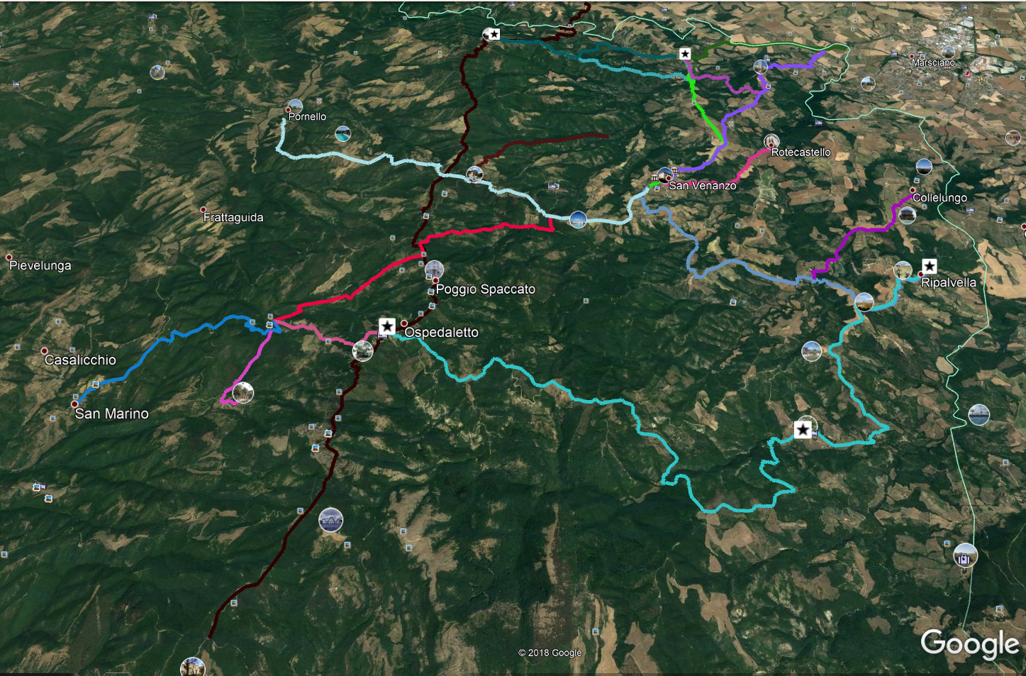
Ospedaletto – Ripalvella
Distance (km)
Climb
Descent
It is strongly recommended to download the route to your device, in order to avoid possible track errors.
Warning: there are gates for livestock farms; after passing through, you must always close them again.
Between these two villages there were a lot of traffics of people, animals and goods and the route variations were many, since it could be useful to pass through one farm house rather than another. The route we propose avoids, as far as possible, to insist on today’s route.
From Ospedaletto you take the current road (with indications for Ripalvella) which you follow for 0.68 km. At this point, take a dirt road towards the south-east, slightly uphill (gate to be closed) and follow the track until you reach a gravel road to follow for km. 2.61. Here we will leave again the road that turns sharply to the south to take a dirt path to the east that, following the track, will bring us back to the main road that we will leave only after having covered 4.4 km from the start.
At this point, we will leave the main road again to take a road on the right, almost parallel. After about 200 metres, we’ll have to continue south-east and then turn sharply southwards. We will reach the ruins of Podere Il Pozzo and continue south downhill. Always following the trail, we will reach a clearing that we will have to skirt until we meet, towards east, a ford. After having crossed it, we will continue up a steep slope that will lead us to a plateau where we will turn eastwards on a beautiful and panoramic road. After 8.75 km from the start we will find a crossroads and we will turn left, towards the north-west. Now continue always downhill until the ford (Faena delle Felcete ditch), after which, after about 400 meters, we will be at Podere Felcete.
Between the two buildings of this structure we will find a road going downhill towards north; following it, we will go down and take a south-easterly direction along a pond. We will continue eastwards and, after 11.8 km from the start, we will find an uphill road to the north. Following it, we will take the main road again after 14 km from the start. We will follow it towards north-east until we reach the provincial road that, on the right, will take us to Ripalvella.
DICHIARAZIONE DI NON RESPONSABILITÀ: facciamo ogni sforzo per assicurare che le informazioni presenti su questo sito siano accurate. Tuttavia le condizioni possono cambiare quindi ricordiamo sempre che gli utenti sono responsabili per la propria sicurezza.
