Via Orvietana (part)
Distance (km)
Climb
Descent
ATTENTION: the stretch that goes from the bridge over the Fersinone towards the final point to the north is not currently practicable.
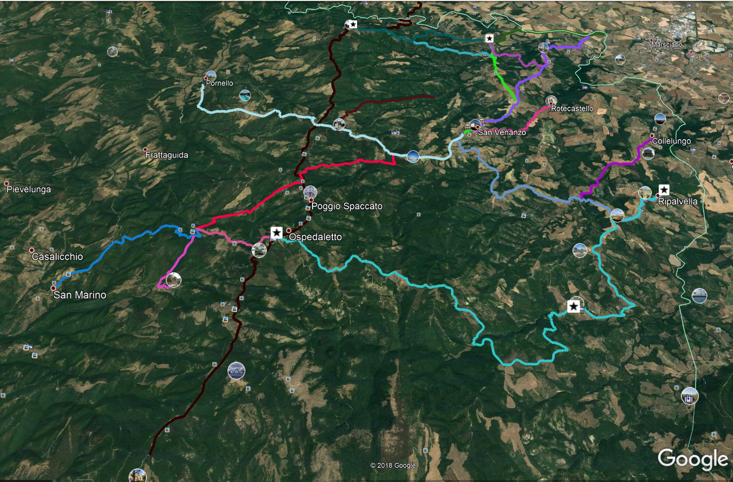
This ancient road, which connected Perugia with Orvieto and along which all the traffic and trade between the two flourishing cities took place, is mapped only for the part included in the territory of San Venanzo Municipality, for now. The rest of the road has to be extracted from the State Archive and geo-referenced, yet.
In its southern part, starting from the border between the Municipalities of Orvieto and San Venanzo, it closely follows the current tarred road (except for a few hairpin bends and a stretch just before Ospedaletto).
The connection ends about 100 meters before the narrowest hairpin bend of this state road, from which you have to take a large unpaved road northwards on the ridge that gradually returns to normal dimensions. Always following the ridge, you reach the asphalt road that leads to San Vito, always heading north. Once you reach the village of Baccano (San Vito in Monte), you have to bend decisively eastwards always following the asphalt road and leave it to take a road on the left (it leads to the cemetery) until you come back close to the main road, which runs alongside for about 100 meters, and then continue on the ancient road, leaving the tarred road. Following the clearly visible track, you reach a well laid out track (150 meters to the left there is Spizzicacacio, an accommodation facility); follow it to the right and, when the road turns sharply, to the right, go straight on along the ridge, reaching the asphalt road after having descended a slope. Cross it, keep going downhill and you will reach the Fersinone torrent, which runs alongside the bridge; pass it and turn right immediately, skirting the river and passing a house; shortly after leaving it behind, leave the edge of the river and follow the dirt road, continuing northwards and entering, shortly afterwards, in a narrow valley with an increasingly steep uphill path which gets over the crags and then reaches the crossroad that, for now, closes this route.
DICHIARAZIONE DI NON RESPONSABILITÀ: facciamo ogni sforzo per assicurare che le informazioni presenti su questo sito siano accurate. Tuttavia le condizioni possono cambiare quindi ricordiamo sempre che gli utenti sono responsabili per la propria sicurezza.
